
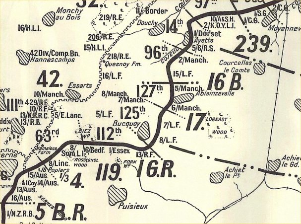
Image: MapBucquoy5April1918
No higher resolution available.
MapBucquoy5April1918.jpg (607 × 451 pixels, file size: 93 KB, MIME type: image/jpeg)
Description: Map showing British and German units around Bucquoy, France during the final day of the German offensive in the area, 5 April 1918.
Title: MapBucquoy5April1918
Credit: British Official History, 1934 edition.
Author: British Government. HM Stationery Office, publisher.
Permission: Crown Copyright expired (50 years)
Usage Terms: Public domain
License: Public domain
Attribution Required?: No
Image usage
The following page links to this image:

All content from Kiddle encyclopedia articles (including the article images and facts) can be freely used under Attribution-ShareAlike license, unless stated otherwise.