
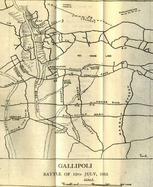
Image: MapAchiBabaNullahAttack12July1915
Size of this preview: 490 × 599 pixels. Other resolutions: 196 × 240 pixels | 538 × 658 pixels.
Original image (538 × 658 pixels, file size: 128 KB, MIME type: image/jpeg)
Description: Sketch Map showing area of British attack along Achi Baba Nullah, Gallipoli peninsula, 12 July 1915, including trench lines.
Title: MapAchiBabaNullahAttack12July1915
Credit: published in "The Fifth Battalion Highland Light Infantry in the War 1914-1918" by Colonel F.L.Morrison. Downloaded from http://www.gutenberg.org/etext/20250
Author: author of map not identified
Permission: copyright expired
Usage Terms: Public domain
License: Public domain
Attribution Required?: No
Image usage
The following 2 pages link to this image:

All content from Kiddle encyclopedia articles (including the article images and facts) can be freely used under Attribution-ShareAlike license, unless stated otherwise.