
Image: Map1906
Size of this preview: 569 × 599 pixels. Other resolutions: 228 × 240 pixels | 640 × 674 pixels.
Original image (640 × 674 pixels, file size: 97 KB, MIME type: image/jpeg)
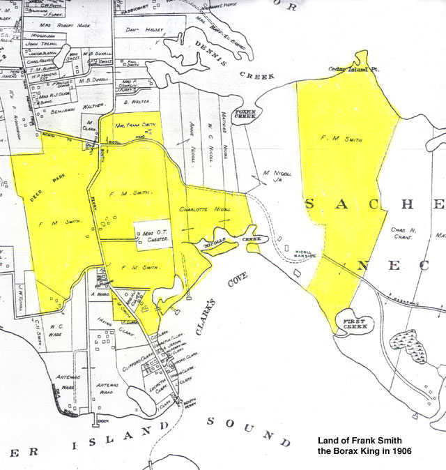
Description: Map of shelter island in 1906, lands owned by Francis Smith at sachems neck, at then Clark Cove, later renamed Smith's Cove.
Title: Map1906
Credit: https://web.archive.org/web/20120807235008/http://www.shelter-island.org/smith/index.html
Author: Unknown authorUnknown author
Usage Terms: Public domain
License: Public domain
Attribution Required?: No
Image usage
The following page links to this image:

All content from Kiddle encyclopedia articles (including the article images and facts) can be freely used under Attribution-ShareAlike license, unless stated otherwise.