
Image: Map-of-southeast-asia 1400 CE-es

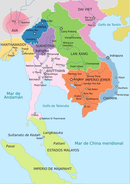
Description: Map of Southeast Asia circa 1400 CE, showing Khmer Empire in red, Ayutthaya Kingdom in violet, Lan Xang kingdom in teal, Sukhothai kingdom in orange, Champa in yellow, Kingdom of Lanna in purple, Dai Viet in blue and surrounding states.
Title: Map-of-southeast-asia 1400 CE-es
Credit: Map-of-southeast-asia 1400 CE.png Map-of-southeast-asia 900 CE-es.svg http://ecaimaps.berkeley.edu/animations/2003_03_khmer_animation.swf http://www.britannica.com/EBchecked/media/3395/Khmer-empire-1200 Atlas of world history, Patrick Karl O'brien. Societies, Networks, and Transitions: A Global History, Volume B. Craig A.Lockard http://upload.wikimedia.org/wikipedia/commons/thumb/4/45/Srivijaya_Empire.svg/2000px-Srivijaya_Empire.svg.png File:DvaravatiMapThailand.png http://upload.wikimedia.org/wikipedia/commons/e/eb/Thailand_2002_CIA_map.jpg
Author: Map-of-southeast-asia 1400 CE.png: Javierfv1212 Map-of-southeast-asia 900 CE-es.svg: Rowanwindwhistler derivative work: Rowanwindwhistler (talk)
Usage Terms: Creative Commons Attribution-Share Alike 4.0
License: CC BY-SA 4.0
License Link: https://creativecommons.org/licenses/by-sa/4.0
Attribution Required?: Yes
Image usage
The following page links to this image:
