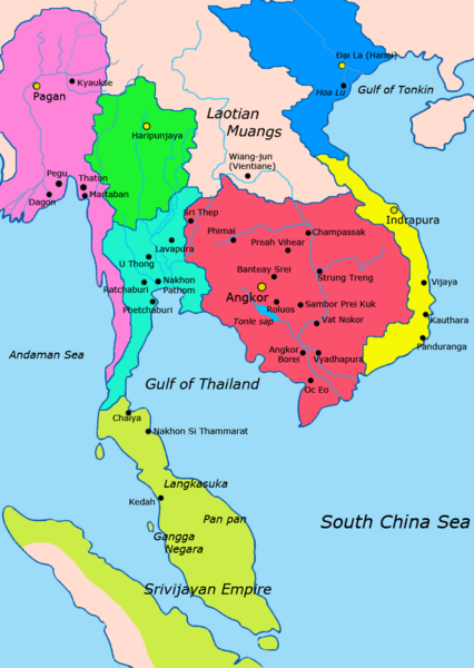
Image: Map-of-southeast-asia 1000 - 1100 CE

Description: Map of Mainland Southeast Asia circa 1000 - 1100 CE, showing Khmer Empire in red, Lavo kingdom/Dvaravati in light blue, Haripunjaya in green, Champa in yellow, Dai Viet in blue, Kingdom of Pagan in pink, Srivijaya in lime and surrounding states. sources http://ecaimaps.berkeley.edu/animations/2003_03_khmer_animation.swf http://www.britannica.com/EBchecked/media/3395/Khmer-empire-1200 Atlas of world history, Patrick Karl O'brien Societies, Networks, and Transitions: A Global History, Volume B. Craig A.Lockard http://upload.wikimedia.org/wikipedia/commons/thumb/4/45/Srivijaya_Empire.svg/2000px-Srivijaya_Empire.svg.png File:DvaravatiMapThailand.png http://upload.wikimedia.org/wikipedia/commons/e/eb/Thailand_2002_CIA_map.jpg
Title: Map-of-southeast-asia 1000 - 1100 CE
Credit: Own work
Author: Javierfv1212
Usage Terms: Creative Commons Zero, Public Domain Dedication
License: CC0
License Link: http://creativecommons.org/publicdomain/zero/1.0/deed.en
Attribution Required?: No
Image usage
The following page links to this image:

