
Image: Map-of-Ottoman-Empire-1900
Size of this preview: 800 × 504 pixels. Other resolutions: 320 × 202 pixels | 1,280 × 806 pixels.
Original image (1,280 × 806 pixels, file size: 190 KB, MIME type: image/png)
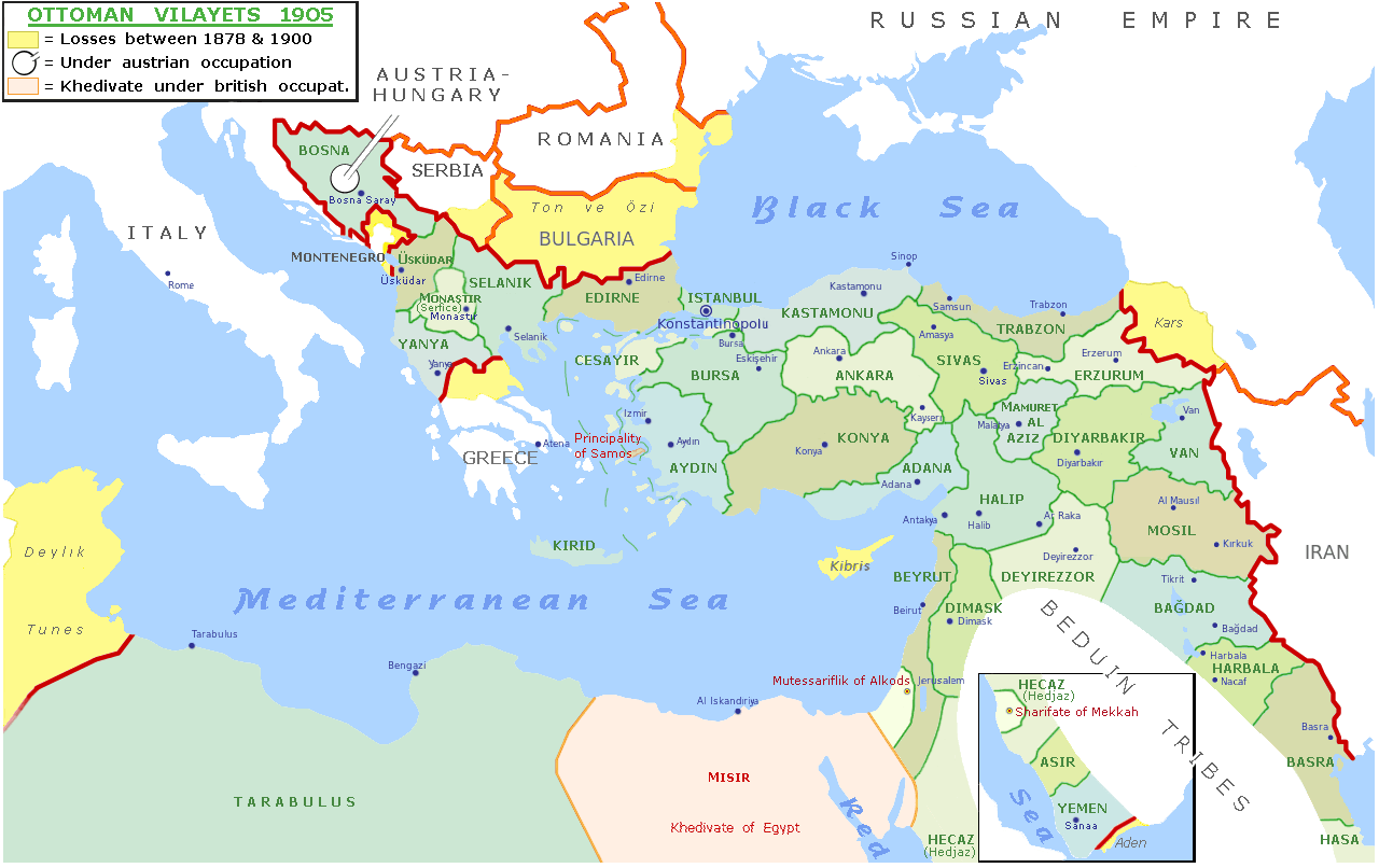
Description: Map of the Ottoman empire in 1900, derivative since File:Map-of-Ottoman-Empire-in-1900-Latvian.svg but in english & with more details since H. E. Stier (dir.), Grosser Atlas zur Weltgeschichte, Westermann eds., Braunschweig 1985, ISBN 3-14-100919-8
Title: Map-of-Ottoman-Empire-1900
Credit: Own work derivative since File:Map-of-Ottoman-Empire-in-1900-Latvian.svg
Author: Julieta39
Usage Terms: Creative Commons Attribution-Share Alike 4.0
License: CC BY-SA 4.0
License Link: https://creativecommons.org/licenses/by-sa/4.0
Attribution Required?: Yes
Image usage
The following 2 pages link to this image:

All content from Kiddle encyclopedia articles (including the article images and facts) can be freely used under Attribution-ShareAlike license, unless stated otherwise.