
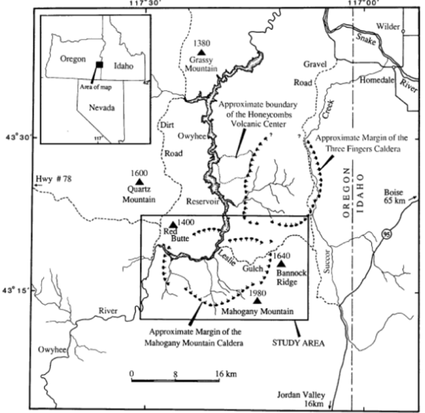
Image: MahoganyMountain area map

Size of this preview: 617 × 599 pixels. Other resolutions: 247 × 240 pixels | 2,284 × 2,218 pixels.
Original image (2,284 × 2,218 pixels, file size: 407 KB, MIME type: image/png)
Description: Location map of the Mahogany Mountain Caldera in Malheur County of eastern Oregon and Owyhee County of western Idaho.
Title: MahoganyMountain area map
Credit: USGS Open File Report 98-77
Author: USGS, Dean B. Vander Meulen
Usage Terms: Public domain
License: Public domain
Attribution Required?: No
Image usage
The following page links to this image:

All content from Kiddle encyclopedia articles (including the article images and facts) can be freely used under Attribution-ShareAlike license, unless stated otherwise.