
Image: Magadha early expansion
Size of this preview: 800 × 475 pixels. Other resolutions: 320 × 190 pixels | 1,500 × 891 pixels.
Original image (1,500 × 891 pixels, file size: 1.85 MB, MIME type: image/gif, looped, 4 frames, 8.0 s)
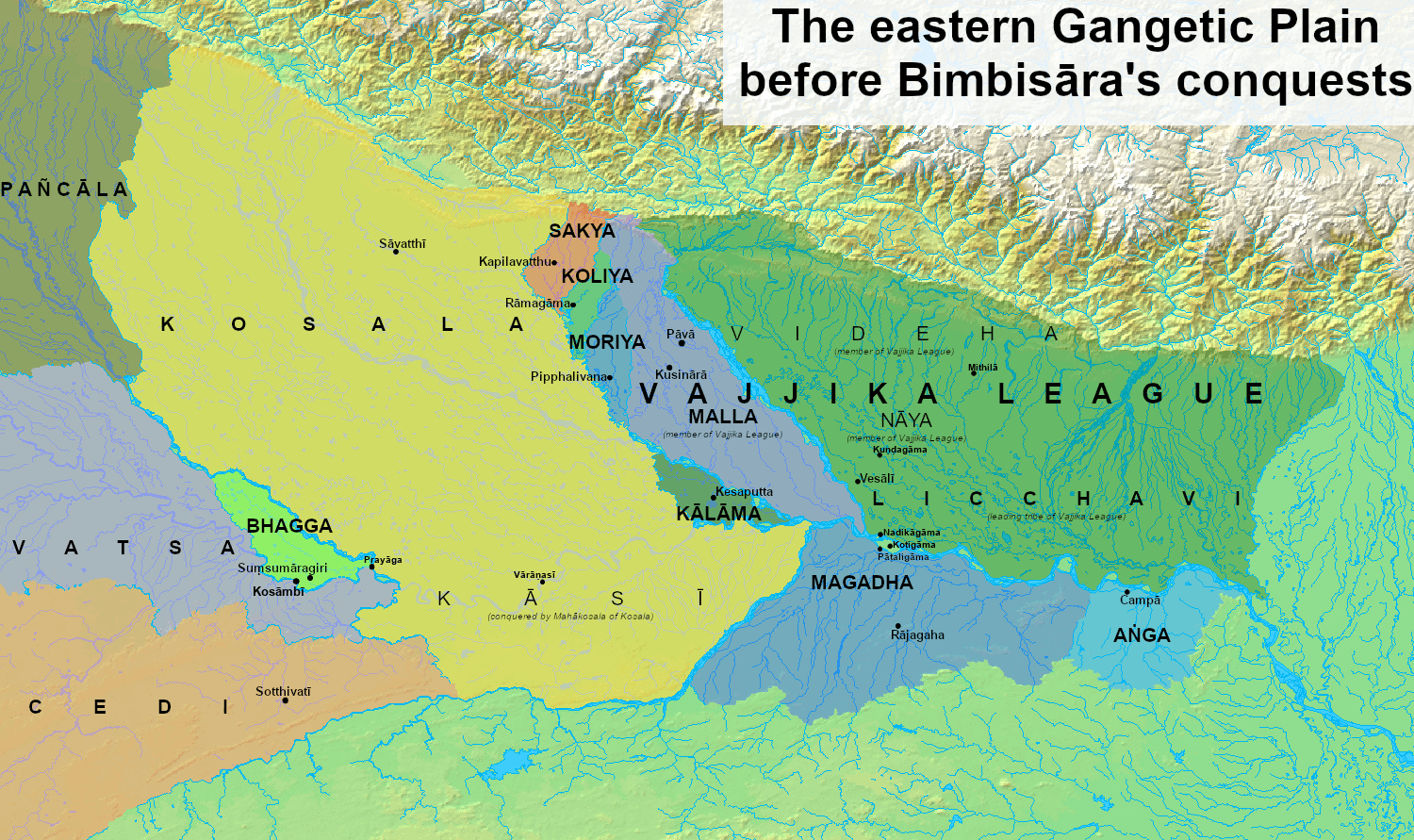
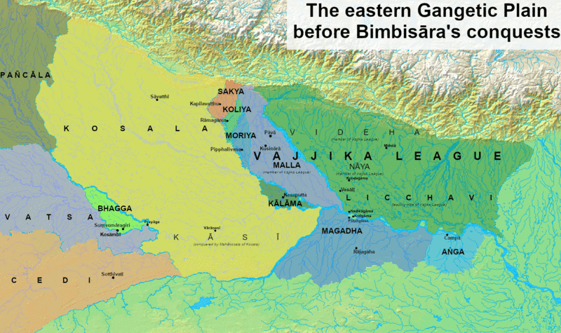
Description: Map of the eastern Gangetic plain during the Magadha kingdom's early expansion
Title: Magadha early expansion
Credit: Own work based on: Sharma, J. P. (1968) Republics in Ancient India, C. 1500 B.C.-500 B.C., Leiden, Netherlands: E. J. Brill ISBN: 978-9-004-02015-3. Raychaudhuri, Hem Chandra (1923) Political History of Ancient India, from the Accession of Parikshit to the Extinction of the Gupta Dynasty, University of Calcutta Background from [1]
Author: Antiquistik
Usage Terms: Creative Commons Attribution-Share Alike 4.0
License: CC BY-SA 4.0
License Link: https://creativecommons.org/licenses/by-sa/4.0
Attribution Required?: Yes
Image usage
The following page links to this image:

All content from Kiddle encyclopedia articles (including the article images and facts) can be freely used under Attribution-ShareAlike license, unless stated otherwise.