
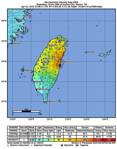
Image: Macroseismic Intensity Map USGS ShakeMap 18 km SSW of Hualien City, Taiwan, TW Apr 02, 2024 M7.4.pdf
Size of this JPG preview of this PDF file: 472 × 599 pixels. Other resolution: 189 × 240 pixels.
Original image (1,232 × 1,564 pixels, file size: 2.2 MB, MIME type: application/pdf)
Description: Macroseismic Intensity Map USGS ShakeMap: 18 km SSW of Hualien City, Taiwan, TW
Apr 02, 2024 23:58:11 UTC M7.4 N23.82 E121.56 Depth: 34.8km ID:us7000m9g4
Usage Terms: Public domain
Image usage
The following page links to this image:

All content from Kiddle encyclopedia articles (including the article images and facts) can be freely used under Attribution-ShareAlike license, unless stated otherwise.