
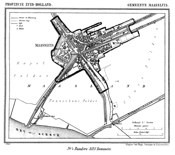
Image: Maassluis 1867

Size of this preview: 678 × 600 pixels. Other resolutions: 271 × 240 pixels | 1,600 × 1,415 pixels.
Original image (1,600 × 1,415 pixels, file size: 201 KB, MIME type: image/png)
Description: Historic map of Maassluis, South Holland, the Netherlands
Title: Maassluis 1867
Credit: Gemeente Atlas van Nederland (Municipal Atlas of the Netherlands)
Author: J. Kuyper
Usage Terms: Public domain
License: Public domain
Attribution Required?: No
Image usage
The following page links to this image:

All content from Kiddle encyclopedia articles (including the article images and facts) can be freely used under Attribution-ShareAlike license, unless stated otherwise.