
Image: MA Norfolk (old) Co towns map
Size of this preview: 411 × 599 pixels. Other resolutions: 165 × 240 pixels | 947 × 1,380 pixels.
Original image (947 × 1,380 pixels, file size: 143 KB, MIME type: image/png)
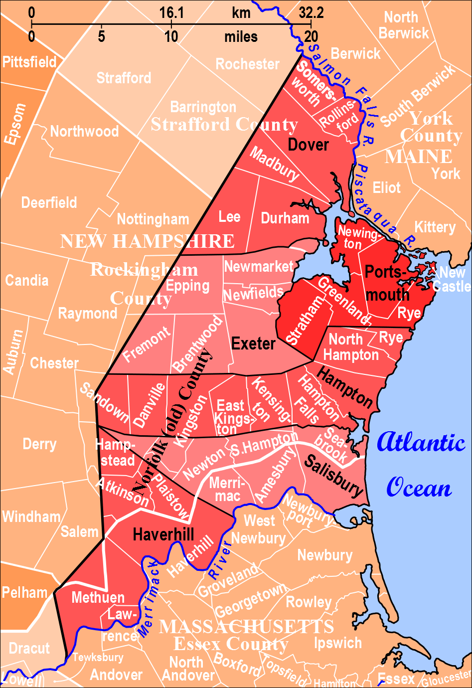
Description: Norfolk County in Massachusetts and New Hampshire (created in 1643 part of Massachusetts Bay Colony) had six towns shown in red and black. These six towns are overlaid on a map of present-day Essex County in Massachusetts, Rockingham County in New Hampshire, Strafford County in New Hampshire, and surrounding towns with borders in white.
Title: MA Norfolk (old) Co towns map
Credit: Own work
Author: Diltsgd
Usage Terms: Creative Commons Zero, Public Domain Dedication
License: CC0
License Link: http://creativecommons.org/publicdomain/zero/1.0/deed.en
Attribution Required?: No
Image usage
The following page links to this image:

All content from Kiddle encyclopedia articles (including the article images and facts) can be freely used under Attribution-ShareAlike license, unless stated otherwise.
_Co_towns_map.png)