
Image: Lyscombe Bottom near Higher Melcombe 1 - geograph.org.uk - 466403
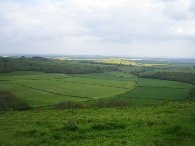
Description: Lyscombe Bottom near Higher Melcombe 1 This view from Lyscombe Hill at a height of about 240m and looking south-east is of Lyscombe Bottom. This is a coombe, a steep sided dry valley formed in freely draining chalk downland. Traces of medieval settlement patterns and some barrows (mounds of earth and stones raised over a grave) have been found in Lyscombe Bottom. On the nearby hills are numerous cross dykes, tumuli and a hill fort. In the middle distance two woods almost meet at about 130m, and Lyscombe Farm can just be seen amongst the trees. Barely visible in the far distance beyond the Frome valley are the Purbeck Hills.
Title: Lyscombe Bottom near Higher Melcombe 1 - geograph.org.uk - 466403
Credit: From geograph.org.uk
Author: Andy Gryce
Usage Terms: Creative Commons Attribution-Share Alike 2.0
License: CC BY-SA 2.0
License Link: https://creativecommons.org/licenses/by-sa/2.0
Attribution Required?: Yes
Image usage
The following 2 pages link to this image:
