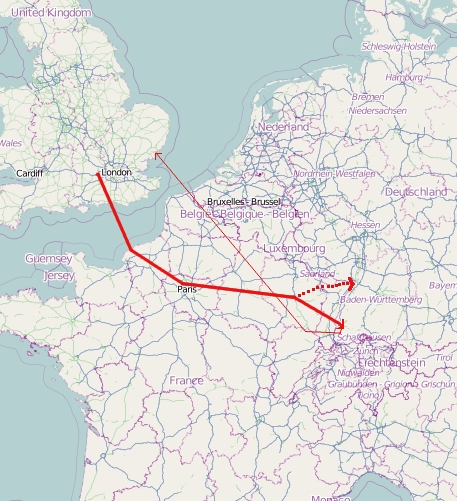
Image: Luftangriff Freiburg 27.11.1944
Luftangriff_Freiburg_27.11.1944.jpg (457 × 501 pixels, file size: 216 KB, MIME type: image/jpeg)
Description: Flight routes of 1st and 8th groups of British bomber command planes on November 27, 1944. This map was created from OpenStreetMap project data, collected by the community. This map may be incomplete and may contain errors. Don't rely solely on it for navigation. Map created according to data in: Gerd R. Ueberschär, Freiburg im Luftkrieg 1939-1945 (Freiburg im Breisgau/Munich, 1990), illustration 127. ISBN 3-87640-332-4.
Title: Luftangriff Freiburg 27.11.1944
Credit: www.openstreetmap.org
Author: OpenStreetMap contributors
Usage Terms: Creative Commons Attribution-Share Alike 3.0
License: CC BY-SA 3.0
License Link: https://creativecommons.org/licenses/by-sa/3.0
Attribution Required?: Yes
Image usage
The following page links to this image:

All content from Kiddle encyclopedia articles (including the article images and facts) can be freely used under Attribution-ShareAlike license, unless stated otherwise.

