
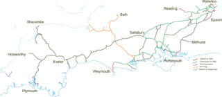
Image: Lswr map 1890

Size of this preview: 800 × 351 pixels. Other resolutions: 320 × 140 pixels | 3,286 × 1,440 pixels.
Original image (3,286 × 1,440 pixels, file size: 101 KB, MIME type: image/gif)
Description: Map of L&SWR system at 1890
Title: Lswr map 1890
Credit: Transferred from en.wikipedia to Commons by Oxyman using CommonsHelper.
Author: Afterbrunel at English Wikipedia
Usage Terms: Public domain
License: Public domain
Attribution Required?: No
Image usage
The following page links to this image:

All content from Kiddle encyclopedia articles (including the article images and facts) can be freely used under Attribution-ShareAlike license, unless stated otherwise.