
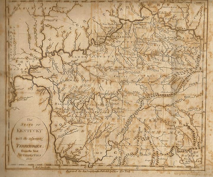
Image: LowsKentuckyMap

Size of this preview: 721 × 599 pixels. Other resolutions: 289 × 240 pixels | 2,748 × 2,284 pixels.
Original image (2,748 × 2,284 pixels, file size: 2.91 MB, MIME type: image/jpeg)
Description: Lows Map of Kentucky and neighboring Territories
Title: LowsKentuckyMap
Credit: Own work
Author: DigbyDalton
Usage Terms: Creative Commons Attribution-Share Alike 3.0
License: CC BY-SA 3.0
License Link: http://creativecommons.org/licenses/by-sa/3.0
Attribution Required?: Yes
Image usage
The following 4 pages link to this image:

All content from Kiddle encyclopedia articles (including the article images and facts) can be freely used under Attribution-ShareAlike license, unless stated otherwise.