
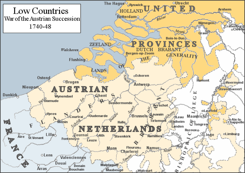
Image: Low Countries 1740

Size of this preview: 800 × 566 pixels. Other resolutions: 320 × 226 pixels | 813 × 575 pixels.
Original image (813 × 575 pixels, file size: 225 KB, MIME type: image/png)
Description: Map of the Low Countries mid-18th Century. Based on map in G. M. Trevelyan's England Under Queen Anne: Blenheim
Title: Low Countries 1740
Credit: Own work
Author: Rebel Redcoat
Usage Terms: Public domain
License: Public domain
Attribution Required?: No
Image usage
The following 3 pages link to this image:

All content from Kiddle encyclopedia articles (including the article images and facts) can be freely used under Attribution-ShareAlike license, unless stated otherwise.