
Image: LouisvilleDefences1864
Size of this preview: 800 × 582 pixels. Other resolutions: 320 × 233 pixels | 1,200 × 873 pixels.
Original image (1,200 × 873 pixels, file size: 347 KB, MIME type: image/jpeg)
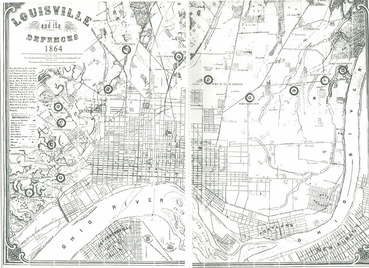
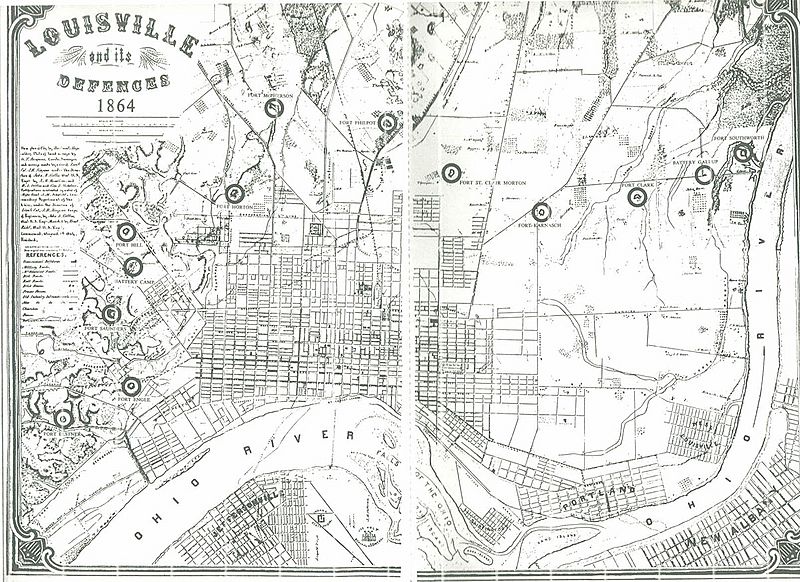
Description: Map of Louisville defenses during the Civil War (1864), published in 1864.
Title: LouisvilleDefences1864
Usage Terms: Public domain
License: Public domain
Attribution Required?: No
Image usage
The following 2 pages link to this image:

All content from Kiddle encyclopedia articles (including the article images and facts) can be freely used under Attribution-ShareAlike license, unless stated otherwise.