
Image: Loudon-map-1839-tn1
No higher resolution available.
Loudon-map-1839-tn1.gif (465 × 348 pixels, file size: 103 KB, MIME type: image/gif)
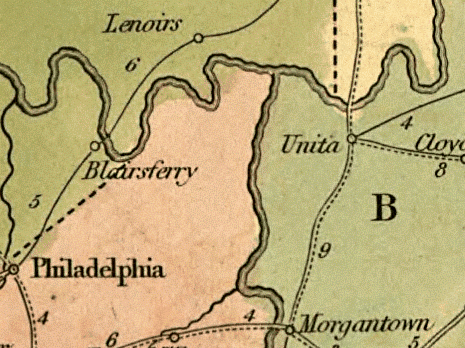
Description: 1839-era map showing what is now Loudon County in the U.S. state of Tennessee. "Lenoirs" refers to the Lenoir family estate, now Lenoir City. "Blairs Ferry" is now Loudon. "Morgantown" (Morganton) is now submerged by Tellico Lake, but roughly corresponds to modern Greenback.
Title: Loudon-map-1839-tn1
Credit: U.S. Library of Congress Digital Map Collections
Author: David H. Burr
Usage Terms: Public domain
License: Public domain
Attribution Required?: No
Image usage
The following page links to this image:

All content from Kiddle encyclopedia articles (including the article images and facts) can be freely used under Attribution-ShareAlike license, unless stated otherwise.