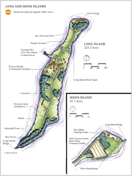
Image: Long and Moon Islands, Boston Harbor, Boston, Massachusetts

Description: Long and Moon islands, two of the Boston Harbor Islands in Boston, Massachusetts, USA. This image is believed to have been produced as part of a re-use planning study for the City of Boston. The map shows the rough location of general features on Long Island. The label "Fort Strong" on the map only refers to the concrete emplacements for Btys Drum, Hitchcock, and Ward on the North Head, not to the whole fort, which in fact occupied the entire northerly 25% of the island. The "Existing Pier" no longer (in 2010) exists, and the site of the "Former Pier" (which is now a brand new existing pier, serving (at least) the children's camp) is in fact located some 500 ft. further north up the shore of the island, just where the former Mining Wharf of the fort was located.
Title: Long and Moon Islands, Boston Harbor, Boston, Massachusetts
Credit: Own work
Usage Terms: Public domain
License: Public domain
Attribution Required?: No
Image usage
The following page links to this image:

