Image: London Ringway 4 1960s Plan

Size of this preview: 600 × 600 pixels. Other resolutions: 240 × 240 pixels | 1,871 × 1,871 pixels.
Original image (1,871 × 1,871 pixels, file size: 460 KB, MIME type: image/png)
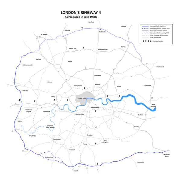
Description: London Ringway 4 Plan from the late 1960s showing roads planned for Ringway 4, indicating those sections of road that were built (becoming parts of the M25 motorway and M26 motorway) and those sections not built. --DavidCane 15:32, 4 February 2007 (UTC)
Title: London Ringway 4 1960s Plan
Credit: Transferred from en.wikipedia to Commons by Oxyman using CommonsHelper.
Author: DavidCane at English Wikipedia
Usage Terms: Creative Commons Attribution-Share Alike 3.0 truetrue
License: CC-BY-SA-3.0
License Link: http://creativecommons.org/licenses/by-sa/3.0/
Attribution Required?: Yes
Image usage
The following page links to this image:

All content from Kiddle encyclopedia articles (including the article images and facts) can be freely used under Attribution-ShareAlike license, unless stated otherwise.
