
Image: London Overground map 2012

Size of this preview: 637 × 600 pixels. Other resolutions: 255 × 240 pixels | 1,600 × 1,506 pixels.
Original image (1,600 × 1,506 pixels, file size: 238 KB, MIME type: image/png)
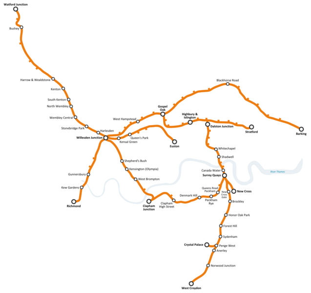
Description: Proposed London Overground network in 2012, once the second phase of the East London Line extension has been built. Note: stations shown with their names are either terminus or those with a transport interchange (rail, underground, DLR, other Overground lines)
Title: London Overground map 2012
Credit: Own work
Author: P Montiel
Usage Terms: Creative Commons Attribution-Share Alike 4.0
License: CC BY-SA 4.0
License Link: https://creativecommons.org/licenses/by-sa/4.0
Attribution Required?: Yes
Image usage
The following page links to this image:

All content from Kiddle encyclopedia articles (including the article images and facts) can be freely used under Attribution-ShareAlike license, unless stated otherwise.