
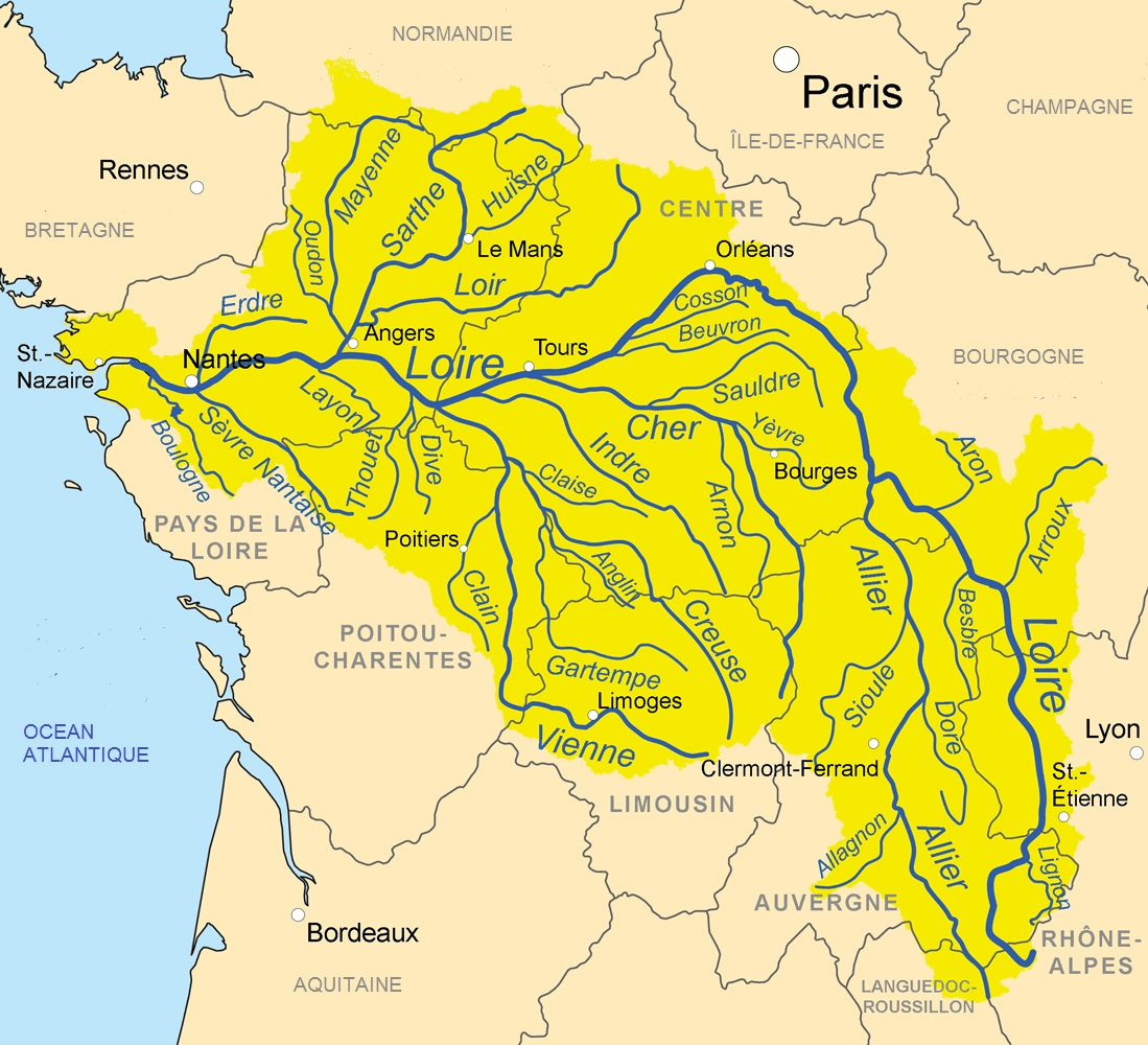
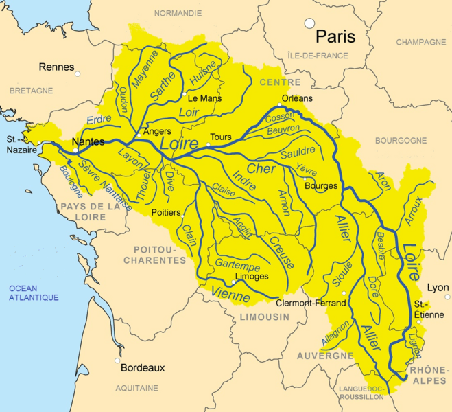
Image: Loire river tribs map
Size of this preview: 659 × 600 pixels. Other resolutions: 264 × 240 pixels | 1,099 × 1,000 pixels.
Original image (1,099 × 1,000 pixels, file size: 1.3 MB, MIME type: image/png)
Description: Map showing the Loire drainage basin and major tributaries.
Title: Loire river tribs map
Credit: Own work, Drainage basin from GTOPO [1], all other features from Vector Map or Natural Earth. National Geographic "Atlas of the World" (1992) used as reference.
Author: Kmusser
Usage Terms: Creative Commons Attribution-Share Alike 3.0
License: CC BY-SA 3.0
License Link: http://creativecommons.org/licenses/by-sa/3.0
Attribution Required?: Yes
Image usage
The following 2 pages link to this image:

All content from Kiddle encyclopedia articles (including the article images and facts) can be freely used under Attribution-ShareAlike license, unless stated otherwise.