
Image: Locator map of Vermillion County, Indiana

Size of this PNG preview of this SVG file: 600 × 600 pixels. Other resolution: 240 × 240 pixels.
Original image (SVG file, nominally 768 × 768 pixels, file size: 179 KB)
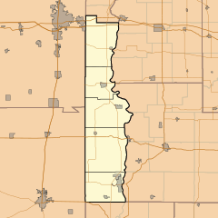
Description: This is a map of Vermillion County, Indiana, USA which includes township borders.
Title: Locator map of Vermillion County, Indiana
Credit: My own work, using freely-available shape data from the United States Census Bureau with a custom-written MapScript application
Author: Omnedon
Usage Terms: Public domain
License: Public domain
Attribution Required?: No
Image usage
The following 25 pages link to this image:
- Alta, Indiana
- Bono, Vermillion County, Indiana
- Centenary, Indiana
- Crompton Hill, Indiana
- Easytown, Indiana
- Eugene, Indiana
- Flat Iron, Indiana
- Gessie, Indiana
- Highland, Vermillion County, Indiana
- Hillsdale, Indiana
- Jonestown, Indiana
- Klondyke, Indiana
- Needmore, Vermillion County, Indiana
- Quaker, Indiana
- Randall, Indiana
- Rhodes, Indiana
- Rileysburg, Indiana
- Sandytown, Indiana
- Summit Grove, Indiana
- Syndicate, Indiana
- Tighe, Indiana
- Toronto, Indiana
- Tree Spring, Indiana
- West Clinton, Indiana
- West Dana, Indiana

All content from Kiddle encyclopedia articles (including the article images and facts) can be freely used under Attribution-ShareAlike license, unless stated otherwise.