
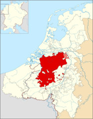
Image: Locator Duchy of Brabant (1350)

Size of this PNG preview of this SVG file: 468 × 599 pixels. Other resolution: 187 × 240 pixels.
Original image (SVG file, nominally 2,818 × 3,608 pixels, file size: 427 KB)
Description: Locator map of the en:Duchy of Brabant in 1350.
Title: Locator Duchy of Brabant (1350)
Credit: Based on the map 'Lage landen omsteeks 1350' in the De bosatlas van de geschiedenis van Nederland, p. 145 (2011).
Author: Sir Iain
Usage Terms: Creative Commons Attribution-Share Alike 3.0
License: CC BY-SA 3.0
License Link: https://creativecommons.org/licenses/by-sa/3.0
Attribution Required?: Yes
Image usage
The following page links to this image:

All content from Kiddle encyclopedia articles (including the article images and facts) can be freely used under Attribution-ShareAlike license, unless stated otherwise.
.svg)