
Image: Location of Happisburgh
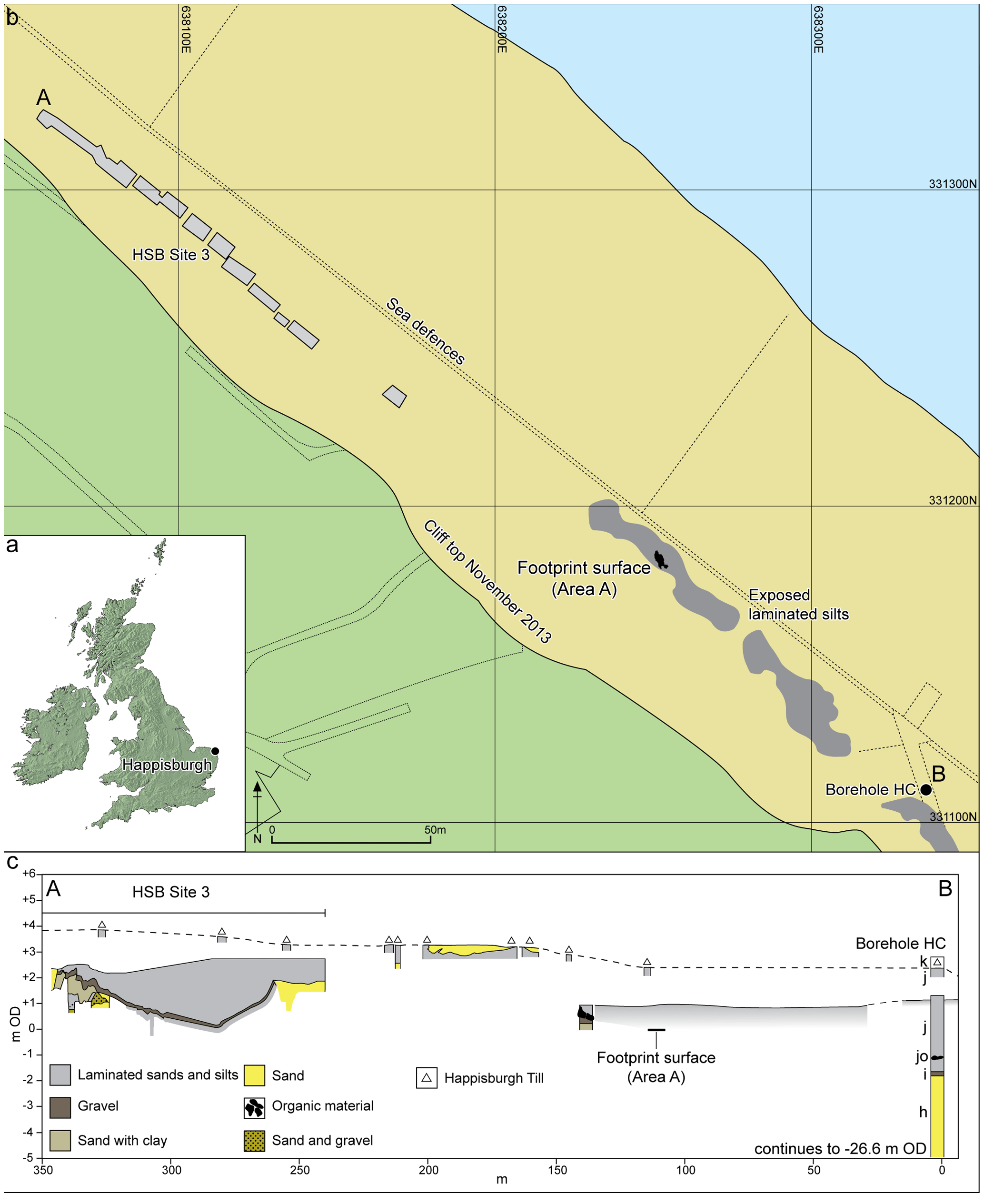
Description: Figure 2. Location of Happisburgh. a. Map of UK showing location of Happisburgh; b. Plan of Happisburgh Site 3, exposed and recorded foreshore sediments, location of footprint surface and of borehole HC; c. Schematic cross-section of recorded sediments from Happisburgh Site 3 through to borehole HC showing stratigraphic position of footprint surface. Beds h–k are shown for borehole HC as recorded by West. doi:10.1371/journal.pone.0088329.g002
Title: Location of Happisburgh
Credit: Nick Ashton, Simon G. Lewis, Isabelle De Groote, Sarah M. Duffy, Martin Bates, Richard Bates, Peter Hoare, Mark Lewis, Simon A. Parfitt, Sylvia Peglar, Craig Williams, Chris Stringer (2014) Hominin Footprints from Early Pleistocene Deposits at Happisburgh, UK. PLoS ONE 9(2): e88329. doi:10.1371/journal.pone.0088329
Author: Nick Ashton, Simon G. Lewis, Isabelle De Groote, Sarah M. Duffy, Martin Bates, Richard Bates, Peter Hoare, Mark Lewis, Simon A. Parfitt, Sylvia Peglar, Craig Williams, Chris Stringer
Usage Terms: Creative Commons Attribution 4.0
License: CC BY 4.0
License Link: http://creativecommons.org/licenses/by/4.0
Attribution Required?: Yes
Image usage
The following page links to this image:
