
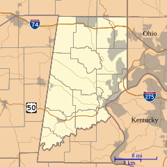
Image: Location map of Dearborn County, Indiana

Size of this PNG preview of this SVG file: 600 × 600 pixels. Other resolution: 240 × 240 pixels.
Original image (SVG file, nominally 960 × 960 pixels, file size: 1.67 MB)
Description: This is a map of Dearborn County, Indiana, USA which includes incorporated settlements, township borders, and major highways.
Title: Location map of Dearborn County, Indiana
Credit: My own work, using custom-written MapScript applications with United States Census Bureau data
Author: Omnedon
Usage Terms: Public domain
License: Public domain
Attribution Required?: No
Image usage
The following 19 pages link to this image:
- Bonnell, Indiana
- Braysville, Indiana
- Chesterville, Indiana
- Cold Springs, Indiana
- Dover, Indiana
- Farmers Retreat, Indiana
- Guilford, Indiana
- Hardinsburg, Dearborn County, Indiana
- Kyle, Indiana
- Lawrenceville, Indiana
- Logan, Dearborn County, Indiana
- Manchester, Indiana
- Mount Sinai, Indiana
- New Alsace, Indiana
- Sparta, Indiana
- Weisburg, Indiana
- Wilmington, Indiana
- Wrights Corner, Indiana
- Yorkville, Indiana

All content from Kiddle encyclopedia articles (including the article images and facts) can be freely used under Attribution-ShareAlike license, unless stated otherwise.