
Image: Location map of Clinton County, Indiana

Size of this PNG preview of this SVG file: 600 × 600 pixels. Other resolution: 240 × 240 pixels.
Original image (SVG file, nominally 960 × 960 pixels, file size: 1.34 MB)
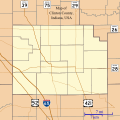
Description: This is a map of Clinton County, Indiana, USA which includes incorporated settlements, township borders, and major highways.
Title: Location map of Clinton County, Indiana
Credit: My own work, using custom-written MapScript applications with United States Census Bureau data
Author: Omnedon
Usage Terms: Public domain
License: Public domain
Attribution Required?: No
Image usage
The following 21 pages link to this image:
- Antioch, Clinton County, Indiana
- Avery, Indiana
- Beard, Indiana
- Boyleston, Indiana
- Cambria, Indiana
- Cyclone, Indiana
- Edna Mills, Indiana
- Fickle, Indiana
- Forest, Indiana
- Geetingsville, Indiana
- Hamilton, Clinton County, Indiana
- Hillisburg, Indiana
- Jefferson, Indiana
- Kilmore, Indiana
- Manson, Indiana
- Middlefork, Clinton County, Indiana
- Moran, Indiana
- Pickard, Indiana
- Reagan, Indiana
- Scircleville, Indiana
- Sedalia, Indiana

All content from Kiddle encyclopedia articles (including the article images and facts) can be freely used under Attribution-ShareAlike license, unless stated otherwise.