
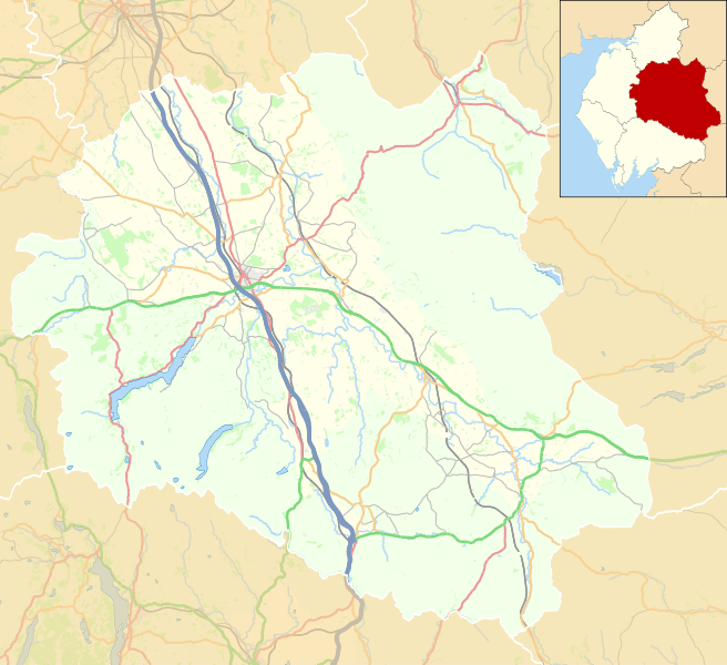
Image: Location map United Kingdom Eden

Description: Location map of Eden District, Cumbria, England in 2021, showing roads, railways, rivers and built-up areas. Inset highlights Eden among all the districts of Cumbria. Equirectangular map projection on WGS 84 datum, with N/S stretched 170% Geographic limits: West: 3.11°W East: 2.05°W North: 54.90°N South: 54.33°N Key Motorway Primary route Other A road B road Other road Railway River National park or Area of Outstanding Natural Beauty Woodland Built-up area
Title: Location map United Kingdom Eden
Credit: This file was derived from: Eden UK ward map 2010 (blank).svg: https://www.openstreetmap.org/#map=9/54.4692/-2.3703 accessed 1 February 2021
Author: Eden UK ward map 2010 (blank).svg: Nilfanion, created using Ordnance Survey data OpenStreetMap: OpenStreetMap contributors derivative work: Dr Greg
Usage Terms: Creative Commons Attribution-Share Alike 4.0
License: CC BY-SA 4.0
License Link: https://creativecommons.org/licenses/by-sa/4.0
Attribution Required?: Yes
Image usage
The following 10 pages link to this image:
