
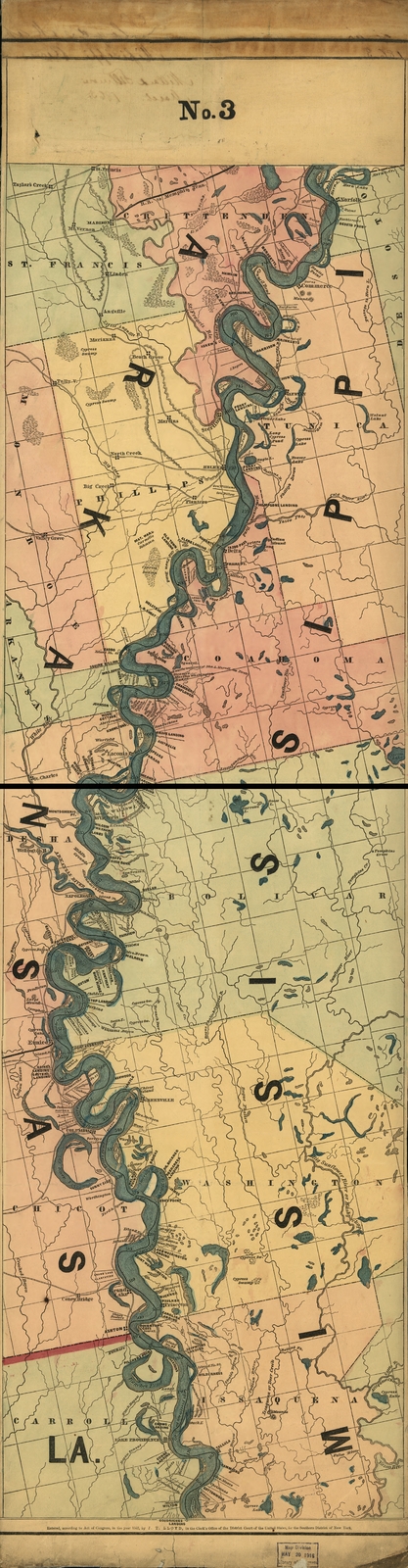
Image: Lloyd's map of the lower Mississippi River (map no. 3)
Size of this preview: 156 × 599 pixels. Other resolutions: 62 × 240 pixels | 3,063 × 11,754 pixels.
Original image (3,063 × 11,754 pixels, file size: 24.15 MB, MIME type: image/jpeg)
Description: Lloyd's map of the lower Mississippi River from St. Louis to the Gulf of Mexico (map no. 3).
Title: Lloyd's map of the lower Mississippi River (map no. 3)
Credit: This map is available from the United States Library of Congress's Geography & Map Division under the digital ID g4042m.rr301390. This tag does not indicate the copyright status of the attached work. A normal copyright tag is still required. See Commons:Licensing for more information.
Author: James T. Lloyd
Usage Terms: Public domain
License: Public domain
Attribution Required?: No
Image usage
The following image is a duplicate of this image (more details):
.jpg)

All content from Kiddle encyclopedia articles (including the article images and facts) can be freely used under Attribution-ShareAlike license, unless stated otherwise.
.jpg)