
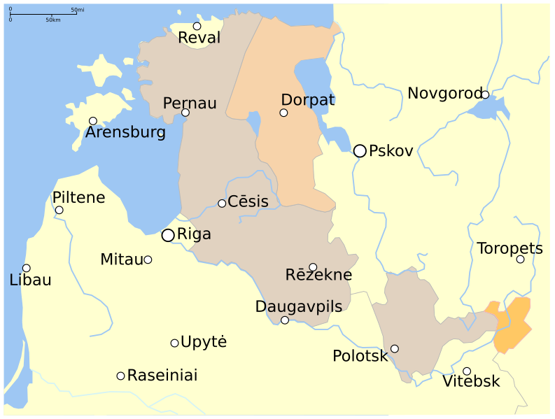
Image: Livonian war map (1570-1577)

Size of this PNG preview of this SVG file: 793 × 600 pixels. Other resolution: 318 × 240 pixels.
Original image (SVG file, nominally 845 × 639 pixels, file size: 56 KB)
Description: Map showing areas of Russian and [Polish-]Lithuanian forces, 1570-1577. occupied by Russian forces in 1570 occupied by Russian forces 1572–1577 occupied by Lithuanian forces
Title: Livonian war map (1570-1577)
Credit: Map_of_Poland_and_Lithuania_in_1600.svg; (2001) Lietuvos istorijos atlasas, Vilnius: Vaga, pp. 16-17 ISBN 5-415-01577-9.
Author: Map_of_Poland_and_Lithuania_in_1600.svg: *Rzeczpospolita_1600.png: User:Halibutt derivative work: Grandiose (talk) derivative work: Grandiose (talk)
Usage Terms: Creative Commons Attribution-Share Alike 3.0
License: CC BY-SA 3.0
License Link: http://creativecommons.org/licenses/by-sa/3.0/
Attribution Required?: Yes
Image usage
The following page links to this image:

All content from Kiddle encyclopedia articles (including the article images and facts) can be freely used under Attribution-ShareAlike license, unless stated otherwise.
.svg)