
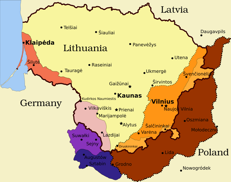
Image: Lithuania territory 1939-1940

Size of this PNG preview of this SVG file: 761 × 600 pixels. Other resolution: 305 × 240 pixels.
Original image (SVG file, nominally 2,479 × 1,954 pixels, file size: 207 KB)
Description: Map of territorial disputes and claims regarding Lithuania in 1939-1940
Title: Lithuania territory 1939-1940
Credit: Self-made using Inkscape; used Image:LithuaniaPhysicalMap-Clean.svg by Knutux for some background features; Source map: (2001) Lietuvos istorijos atlasas, Vilnius: Vaga, p. 44 & 45
Author: This W3C-unspecified vector image was created with Inkscape .
Permission: GFDL & all CC-BY-SA
Usage Terms: Creative Commons Attribution-Share Alike 4.0
License: CC BY-SA 4.0
License Link: https://creativecommons.org/licenses/by-sa/4.0
Attribution Required?: Yes
Image usage
The following 2 pages link to this image:

All content from Kiddle encyclopedia articles (including the article images and facts) can be freely used under Attribution-ShareAlike license, unless stated otherwise.