
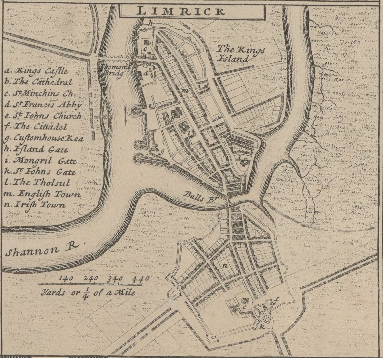
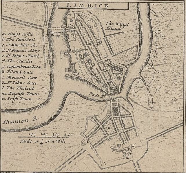
Image: Limrick 1714 (Moll)
Size of this preview: 642 × 600 pixels. Other resolutions: 257 × 240 pixels | 1,331 × 1,243 pixels.
Original image (1,331 × 1,243 pixels, file size: 396 KB, MIME type: image/jpeg)
Description: A detail map of Limerick c. 1714
Notes: Printed for H. Moll over against Devereux Court in ye Strand, I. Bowles at the Black Horse in Cornhill, P. Overton Map & Printseller near St. Dunstans Church Fleetstreet, and T. Bowles Print & Mapseller next to the Chapter house in St. Pauls Church Yard. And by I. King Map and Printseller at the Globe in the Poultry.
Usage Terms: Public domain
Image usage
The following page links to this image:

All content from Kiddle encyclopedia articles (including the article images and facts) can be freely used under Attribution-ShareAlike license, unless stated otherwise.
.jpg)