
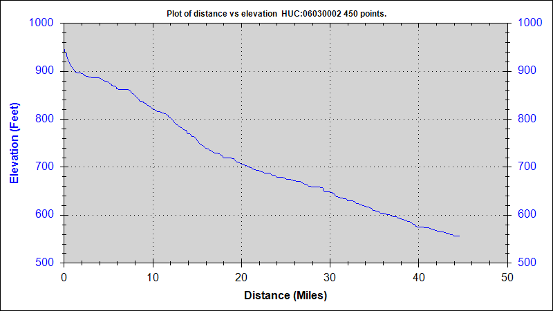
Image: Limestone Creek Elevation
No higher resolution available.
Limestone_Creek_Elevation.png (800 × 450 pixels, file size: 13 KB, MIME type: image/png)
Description: This map was created using USGS StreamStats software. Information generated by this software is considered public domain according to the USGS information policies cited here: http://www.usgs.gov/laws/info_policies.html
Title: Limestone Creek Elevation
Credit: U.S. Geological Survey
Author: U.S. Geological Survey
Usage Terms: Public domain
License: Public domain
Attribution Required?: No
Image usage
The following page links to this image:

All content from Kiddle encyclopedia articles (including the article images and facts) can be freely used under Attribution-ShareAlike license, unless stated otherwise.