
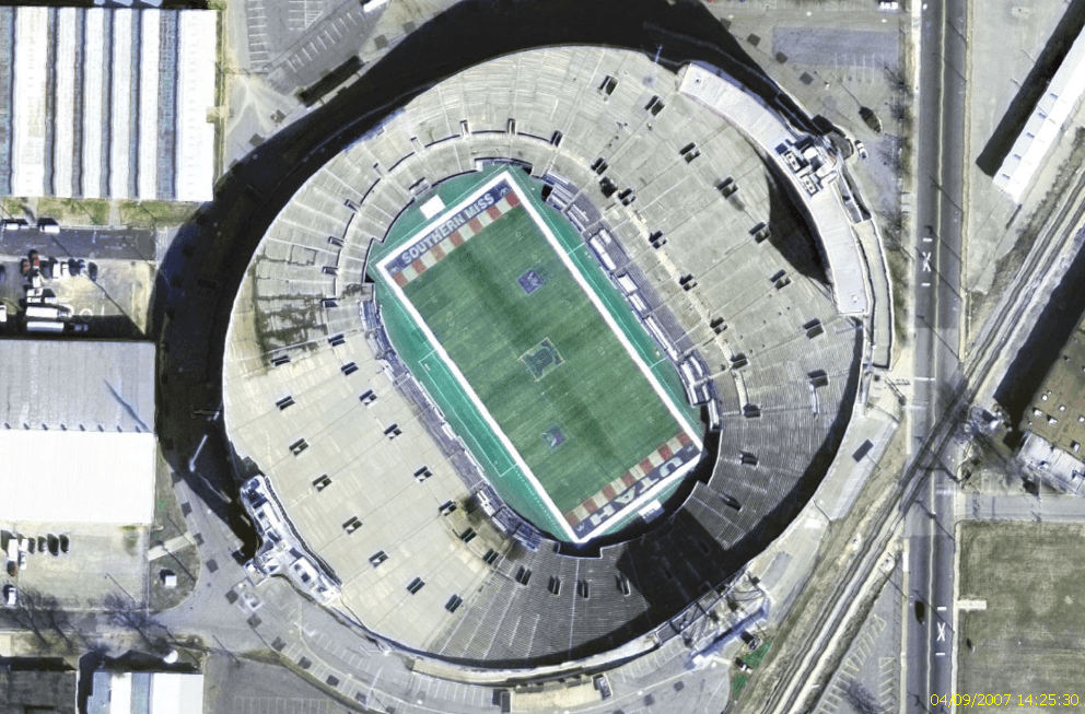
Image: LibertyBowlMemorialStadiumUSGSsat
Size of this preview: 800 × 527 pixels. Other resolutions: 320 × 211 pixels | 992 × 653 pixels.
Original image (992 × 653 pixels, file size: 1.06 MB, MIME type: image/png)
Description: Image satellite du Liberty Bowl Memorial Stadium.
Title: LibertyBowlMemorialStadiumUSGSsat
Credit: Image satellite USGS EROS Ortho prise sur Nasa World Wind Originally from fr.wikipedia; description page is/was here.
Author: NASA
Permission: This image is in the public domain because it is a screenshot from NASA’s globe software World Wind using a public domain layer, such as Blue Marble, MODIS, Landsat, SRTM, USGS or GLOBE. English | فارسی | മലയാളം | Nederlands | Русский | +/−
Usage Terms: Public domain
License: Public domain
Attribution Required?: No
Image usage
The following page links to this image:

All content from Kiddle encyclopedia articles (including the article images and facts) can be freely used under Attribution-ShareAlike license, unless stated otherwise.