
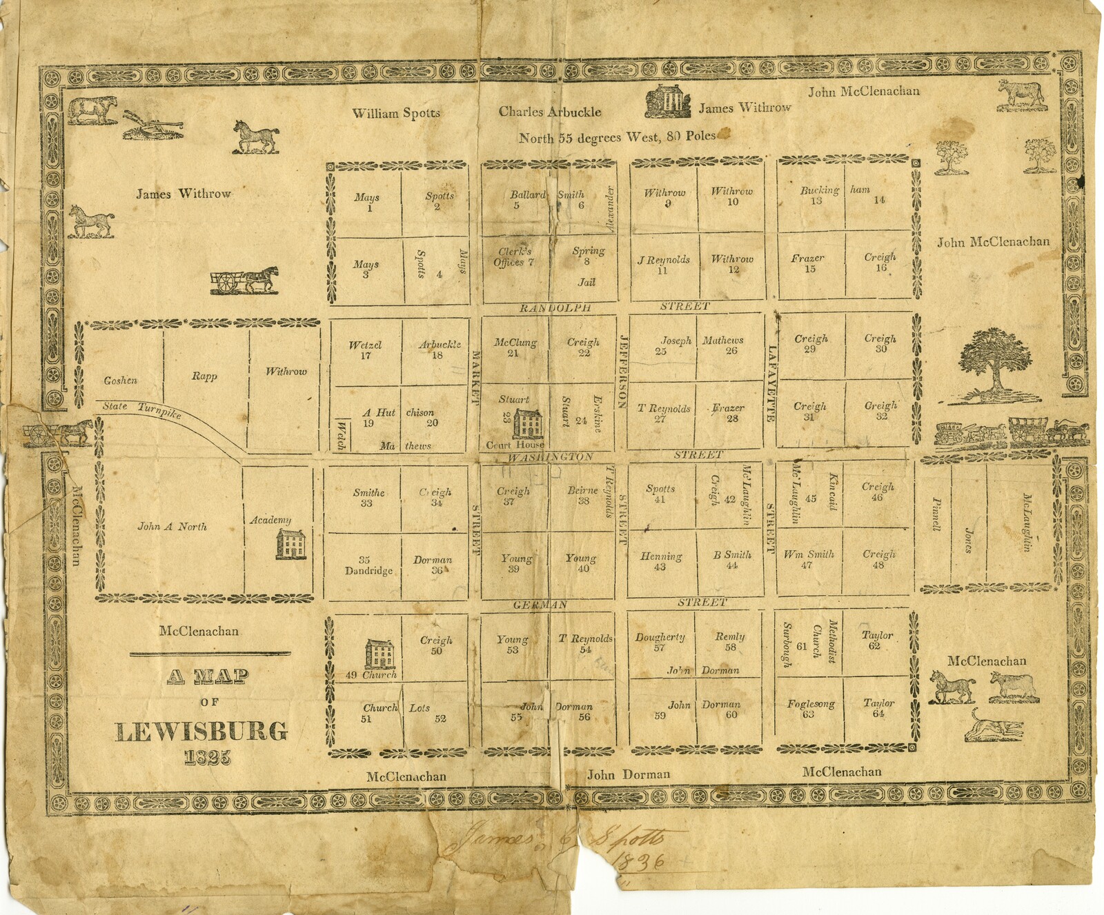
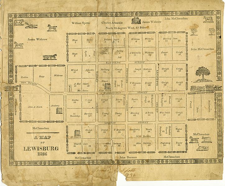
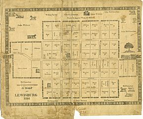
Image: Lewisburg Map 1825
Size of this preview: 723 × 600 pixels. Other resolutions: 289 × 240 pixels | 11,599 × 9,620 pixels.
Original image (11,599 × 9,620 pixels, file size: 30.81 MB, MIME type: image/jpeg)
Description: This map demonstrates early residents of Lewisburg.
Title: Lewisburg Map 1825
Credit: This is a picture of an 1825 map located in the collection of the Greenbrier Historical Society in Lewisburg, West Virginia
Author: Picture taken by Sarah H. Shepherd
Usage Terms: Public domain
License: Public domain
Attribution Required?: No
Image usage
The following 2 pages link to this image:

All content from Kiddle encyclopedia articles (including the article images and facts) can be freely used under Attribution-ShareAlike license, unless stated otherwise.