
Image: Leefgebied Puku-Kobus vardonii

Size of this preview: 600 × 600 pixels. Other resolutions: 240 × 240 pixels | 2,000 × 2,000 pixels.
Original image (2,000 × 2,000 pixels, file size: 105 KB, MIME type: image/png)
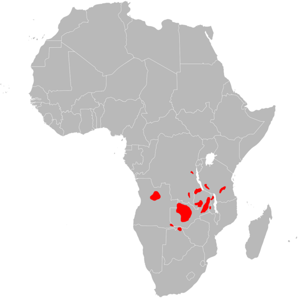
Description: Range map of Puku.
Title: Leefgebied Puku-Kobus vardonii
Credit: Image:BlankMap-Africa.svg, information from [1]
Author: User:Gilado (blank map by User:Lokal_Profil and User:Canuckguy)
Permission: Public domainPublic domainfalsefalse This work has been released into the public domain by its author, Lokal_Profil. This applies worldwide. In some countries this may not be legally possible; if so: Lokal_Profil grants anyone the right to use this work for any purpose, without any conditions, unless such conditions are required by law.
Usage Terms: Public domain
License: Public domain
Attribution Required?: No
Image usage
The following page links to this image:

All content from Kiddle encyclopedia articles (including the article images and facts) can be freely used under Attribution-ShareAlike license, unless stated otherwise.