
Image: Lee ft dm rapids 1837

Size of this preview: 652 × 599 pixels. Other resolutions: 261 × 240 pixels | 863 × 793 pixels.
Original image (863 × 793 pixels, file size: 244 KB, MIME type: image/jpeg)
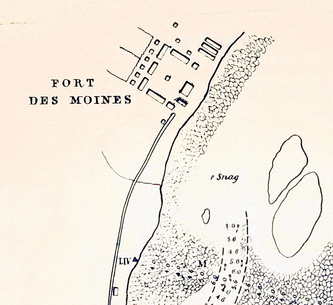
Description: Portion of a map by Robert E. Lee showing Fort Des Moines (later Montrose) at the head of the Des Moines Rapids in Iowa, Sept. 1837.
Title: Lee ft dm rapids 1837
Credit: National Archives, Fortifications map file, Records of the Office of the Chief of Engineers, Record Group 77.
Author: Robert E. Lee, assisted by MC Miegs, IS Morehead,, H. Kaysee
Usage Terms: Public domain
License: Public domain
Attribution Required?: No
Image usage
The following 2 pages link to this image:

All content from Kiddle encyclopedia articles (including the article images and facts) can be freely used under Attribution-ShareAlike license, unless stated otherwise.