
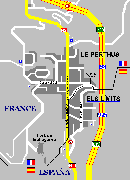
Image: Le Perthus and Els Límits map
Size of this preview: 431 × 599 pixels. Other resolutions: 173 × 240 pixels | 439 × 610 pixels.
Original image (439 × 610 pixels, file size: 9 KB, MIME type: image/png)
Description: Urban map of Le Perthus and Els Límits, the twin villages on the border between France and Spain
Title: Le Perthus and Els Límits map
Credit: Own work
Author: Локоmotiv
Permission: Uses on Wikimedia projects
Usage Terms: Creative Commons Attribution 3.0
License: CC BY 3.0
License Link: https://creativecommons.org/licenses/by/3.0
Attribution Required?: Yes
Image usage
The following page links to this image:

All content from Kiddle encyclopedia articles (including the article images and facts) can be freely used under Attribution-ShareAlike license, unless stated otherwise.