
Image: LarkAndCerberusWreckMap
No higher resolution available.
LarkAndCerberusWreckMap.jpg (600 × 450 pixels, file size: 72 KB, MIME type: image/jpeg)
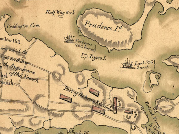
Description: Detail from a 1778 map, drawn by a French military engineer, showing the precise Wreck Sites of HMS Cerberus and HMS Lark, two Royal Navy frigates scuttled upon the arrival of a French fleet in July 1778.
Title: LarkAndCerberusWreckMap
Credit: NOAA Ocean Explorer: http://oceanexplorer.noaa.gov/explorations/08auvfest/background/history/media/rev_war_map.html
Author: A French engineer named Fage
Usage Terms: Public domain
License: Public domain
Attribution Required?: No
Image usage
The following 2 pages link to this image:

All content from Kiddle encyclopedia articles (including the article images and facts) can be freely used under Attribution-ShareAlike license, unless stated otherwise.