
Image: Lane County

Size of this PNG preview of this SVG file: 630 × 450 pixels. Other resolution: 320 × 229 pixels.
Original image (SVG file, nominally 630 × 450 pixels, file size: 55.45 MB)
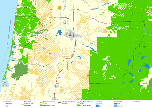
Description: This map shows major highways and roads, cities and federal and state land within Lane County. This map was created in ArcGIS Pro, with data from the Oregon Department of Transportation, the United States Bureau of Land Management and the United States Census Bureau.
Title: Lane County
Credit: Own work
Author: LaMamelle
Usage Terms: Creative Commons Attribution-Share Alike 4.0
License: CC BY-SA 4.0
License Link: https://creativecommons.org/licenses/by-sa/4.0
Attribution Required?: Yes
Image usage
The following page links to this image:

All content from Kiddle encyclopedia articles (including the article images and facts) can be freely used under Attribution-ShareAlike license, unless stated otherwise.