
Image: Lancaster Canal Tramroad map

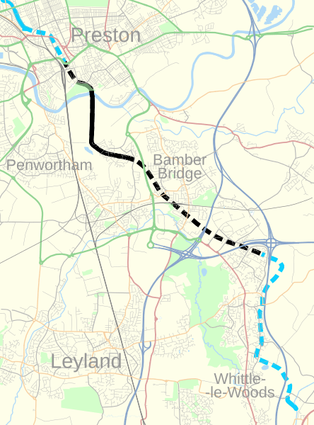
Description: Map of the Lancaster Canal Tramroad, and the southern section of the Lancaster Canal, shown on a 2014 map of part of Lancashire, England. Equirectangular map projection on WGS 84 datum Footpath/cyclepath along route of tramroad Former route of tramroad Extant Lancaster Canal Former route of Lancaster Canal
Title: Lancaster Canal Tramroad map
Credit: This file was derived from: http://www.openstreetmap.org/#map=11/53.7353/-2.6731, accessed 28 July 2014
Author: OpenStreetMap: OpenStreetMap contributors derivative work: Dr Greg
Usage Terms: Creative Commons Attribution-Share Alike 4.0
License: CC BY-SA 4.0
License Link: https://creativecommons.org/licenses/by-sa/4.0
Attribution Required?: Yes
Image usage
The following page links to this image:
