
Image: Lakes of Minneapolis map

Size of this PNG preview of this SVG file: 371 × 599 pixels. Other resolution: 148 × 240 pixels.
Original image (SVG file, nominally 379 × 612 pixels, file size: 54 KB)
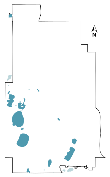
Description: Map of Minneapolis's lakes. Dark blue waterbodies are those counted as lakes at List of lakes in Minneapolis, while light blue are from the City of Minneapolis dataset but aren't included as lakes per se. See the list of lakes in Minneapolis article for more.
Title: Lakes of Minneapolis map
Credit: OpenDataMinneapolis: City boundary Lakes
Author: City of Minneapolis, Collin Knopp-Schwyn
Usage Terms: Creative Commons Attribution-Share Alike 4.0
License: CC BY-SA 4.0
License Link: https://creativecommons.org/licenses/by-sa/4.0
Attribution Required?: Yes
Image usage
The following page links to this image:

All content from Kiddle encyclopedia articles (including the article images and facts) can be freely used under Attribution-ShareAlike license, unless stated otherwise.