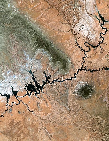
Image: Lake powell utah

Size of this preview: 463 × 599 pixels. Other resolutions: 185 × 240 pixels | 773 × 1,000 pixels.
Original image (773 × 1,000 pixels, file size: 193 KB, MIME type: image/jpeg)
Description: Lake Powell, Utah from NASA's Landsat Lake Powell in southern Utah stretches hundreds of miles from Lees Ferry in Arizona to the Orange Cliffs of southern Utah. At more than 400 feet deep, 150 miles long, and nearly 2,000 miles of shoreline, Lake Powell is the nation's second largest man-made lake, second only to Lake Mead in Nevada. It is at its lowest water level in over 30 years due to the ongoing drought in the western United States.
Title: Lake powell utah
Credit: source
Usage Terms: Public domain
License: Public domain
Attribution Required?: No
Image usage
The following page links to this image:

All content from Kiddle encyclopedia articles (including the article images and facts) can be freely used under Attribution-ShareAlike license, unless stated otherwise.
