
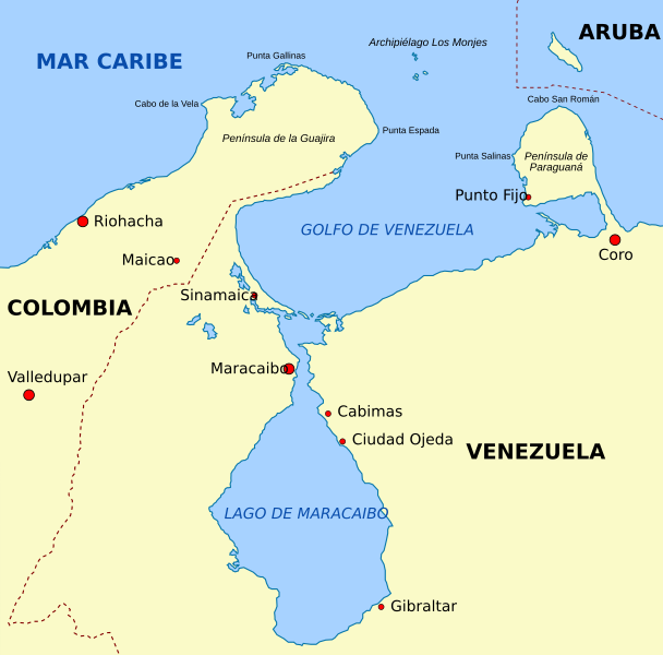
Image: Lake Maracaibo map-es

Size of this PNG preview of this SVG file: 608 × 600 pixels. Other resolution: 243 × 240 pixels.
Original image (SVG file, nominally 1,100 × 1,085 pixels, file size: 46 KB)
Description: Vectorised map of the Area of Maracaibo lake, with Guajira and Paraguana peninsulas, and Netherlands Antilles in spanish language.
Title: Lake Maracaibo map-es
Credit: Lake_Maracaibo_map-fr.svg
Author: derivative work: r@ge (talk) actual version:Milenioscuro Lake_Maracaibo_map-fr.svg: Kimdime69
Usage Terms: Creative Commons Attribution-Share Alike 3.0
License: CC BY-SA 3.0
License Link: http://creativecommons.org/licenses/by-sa/3.0/
Attribution Required?: Yes
Image usage
The following page links to this image:

All content from Kiddle encyclopedia articles (including the article images and facts) can be freely used under Attribution-ShareAlike license, unless stated otherwise.