
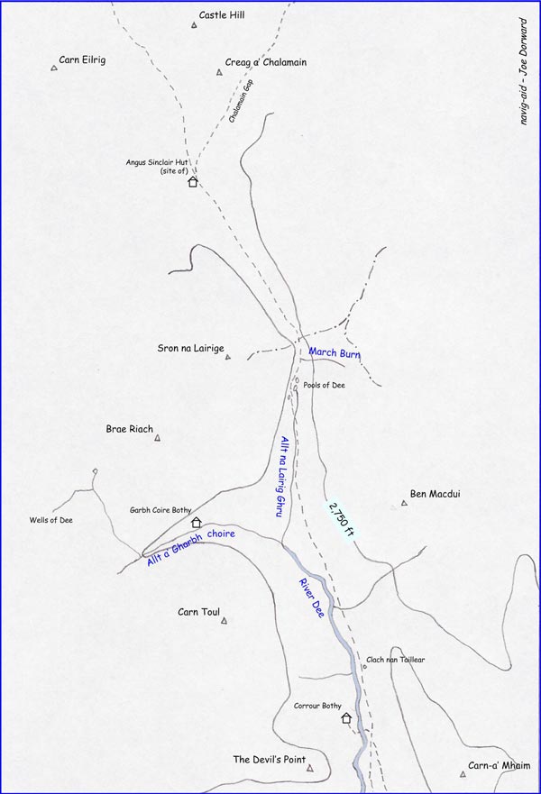
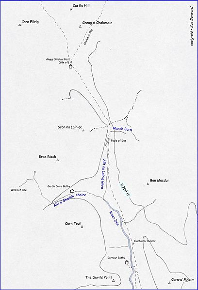
Image: Lairig-ghru-sketch-map
Size of this preview: 408 × 599 pixels. Other resolutions: 163 × 240 pixels | 600 × 881 pixels.
Original image (600 × 881 pixels, file size: 51 KB, MIME type: image/jpeg)
Description: This navig-aid sketch map shows the Lairig Ghru route through the Cairngorms of Scotland with way-points, summits, and the 2,750ft contour-line marked
Title: Lairig-ghru-sketch-map
Credit: Own work
Author: Joe Dorward (TheCreator)
Usage Terms: Public domain
License: Public domain
Attribution Required?: No
Image usage
The following page links to this image:

All content from Kiddle encyclopedia articles (including the article images and facts) can be freely used under Attribution-ShareAlike license, unless stated otherwise.