
Image: Lady Cross and Round Hill - geograph.org.uk - 245915
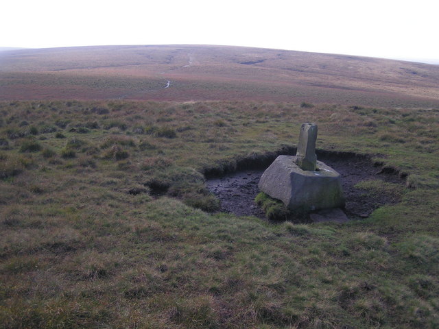
Description: Lady Cross (centre right) and Round Hill (in the distance), South Yorkshire (formerly West Riding). Lady Cross is the base and broken shaft of a former wayside cross beside a former salt road across the Pennines. The path leading toward Round Hill is more on less on the watershed of northern England. Streams to the left flow into the Don and eventually the Humber. Streams to the right flow into the Etherow and eventually the Mersey.
Title: Lady Cross and Round Hill - geograph.org.uk - 245915
Credit: From geograph.org.uk
Author: Dave Dunford
Usage Terms: Creative Commons Attribution-Share Alike 2.0
License: CC BY-SA 2.0
License Link: https://creativecommons.org/licenses/by-sa/2.0
Attribution Required?: Yes
Image usage
The following page links to this image:
