
Image: LACountyPopDensity
Size of this preview: 636 × 600 pixels. Other resolutions: 254 × 240 pixels | 1,429 × 1,348 pixels.
Original image (1,429 × 1,348 pixels, file size: 501 KB, MIME type: image/png)
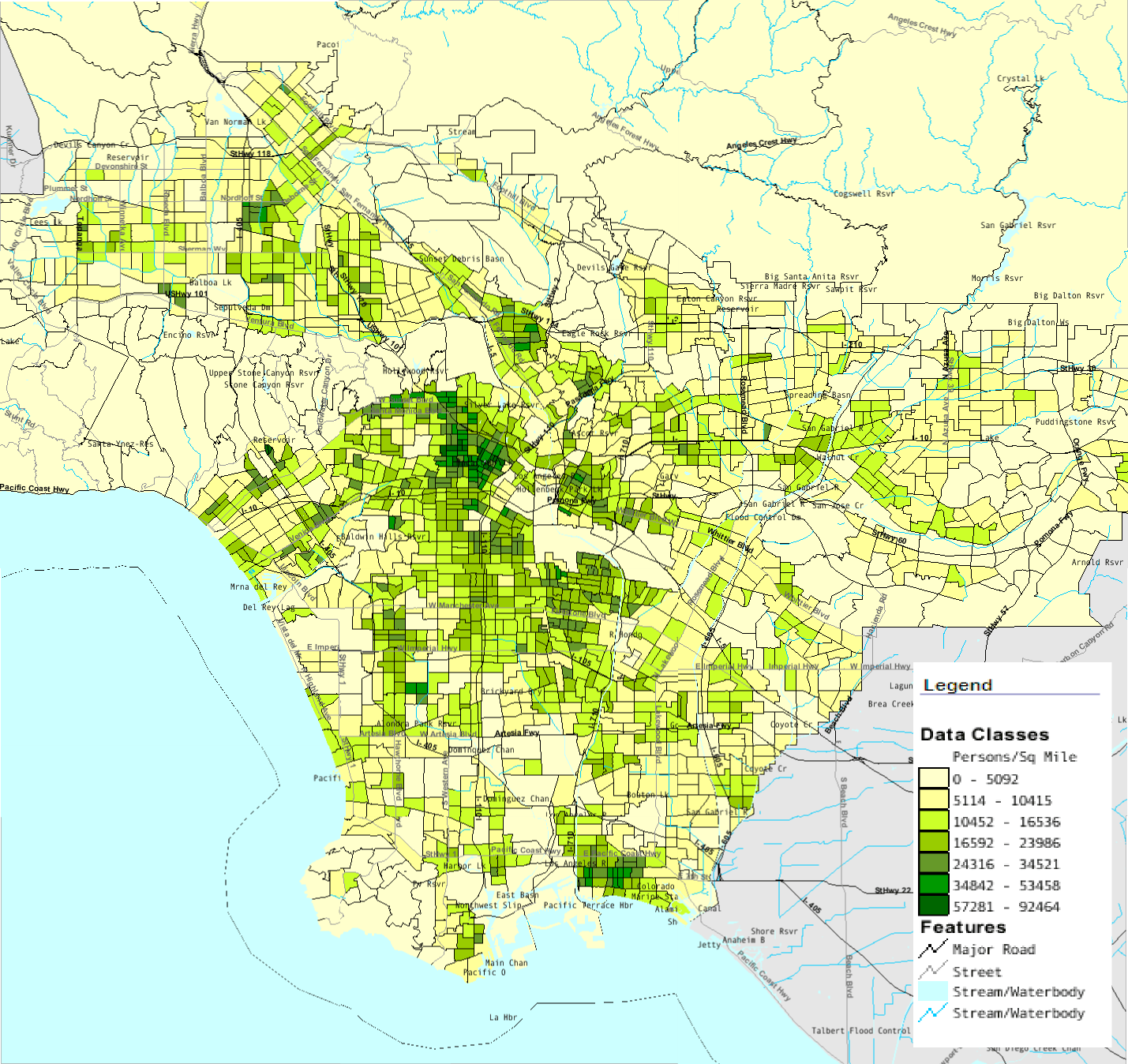
Description: Map of southern Los Angeles County with population density by census tract from 2000 Census
Title: LACountyPopDensity
Credit: U.S. Census Bureau American Fact Finder
Author: U.S. Census Bureau
Usage Terms: Public domain
License: Public domain
Attribution Required?: No
Image usage
The following page links to this image:

All content from Kiddle encyclopedia articles (including the article images and facts) can be freely used under Attribution-ShareAlike license, unless stated otherwise.