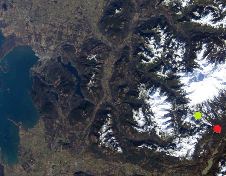
Image: Koma Kulshan Project map
Koma_Kulshan_Project_map.jpg (755 × 589 pixels, file size: 229 KB, MIME type: image/jpeg)
Description: Map of the Koma Kulshan Project on Mount Baker in Washington state (USA). Approximate location of powerhouse shown as red dot, approximate location of dam(s) shown as green dot. Base image is a public domain NASA photograph.
Title: Koma Kulshan Project map
Credit: This file was derived from: ISS008-E-15493 lrg.jpg
Author: Brianhe
Usage Terms: Creative Commons Attribution-Share Alike 4.0
License: CC BY-SA 4.0
License Link: https://creativecommons.org/licenses/by-sa/4.0
Attribution Required?: Yes
Image usage
The following page links to this image:

All content from Kiddle encyclopedia articles (including the article images and facts) can be freely used under Attribution-ShareAlike license, unless stated otherwise.

