
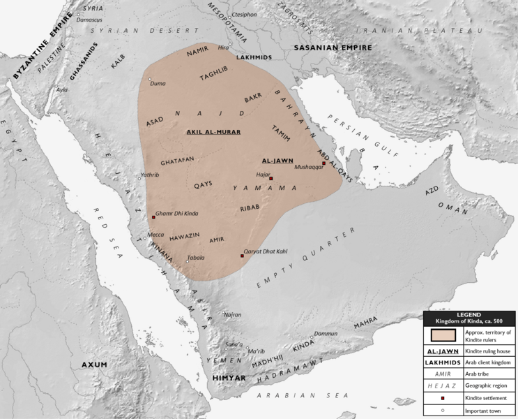
Image: Kindite Kingdom, ca. 500

Size of this preview: 743 × 600 pixels. Other resolutions: 297 × 240 pixels | 1,573 × 1,270 pixels.
Original image (1,573 × 1,270 pixels, file size: 937 KB, MIME type: image/png)
Description: Map showing the approximate extent of the Kindite kingdom over the Ma'add tribal confederation in central and northern Arabia, circa 500 CE. Also shown are the approximate locations of Arab tribes, including the constituents of Ma'add, and neighboring states and Arab client kingdoms. Kindite settlements are distinguished from other important settlements.
Title: Kindite Kingdom, ca. 500
Credit: Own work
Author: Al Ameer son
Usage Terms: Creative Commons Attribution-Share Alike 4.0
License: CC BY-SA 4.0
License Link: https://creativecommons.org/licenses/by-sa/4.0
Attribution Required?: Yes
Image usage
The following page links to this image:

All content from Kiddle encyclopedia articles (including the article images and facts) can be freely used under Attribution-ShareAlike license, unless stated otherwise.