
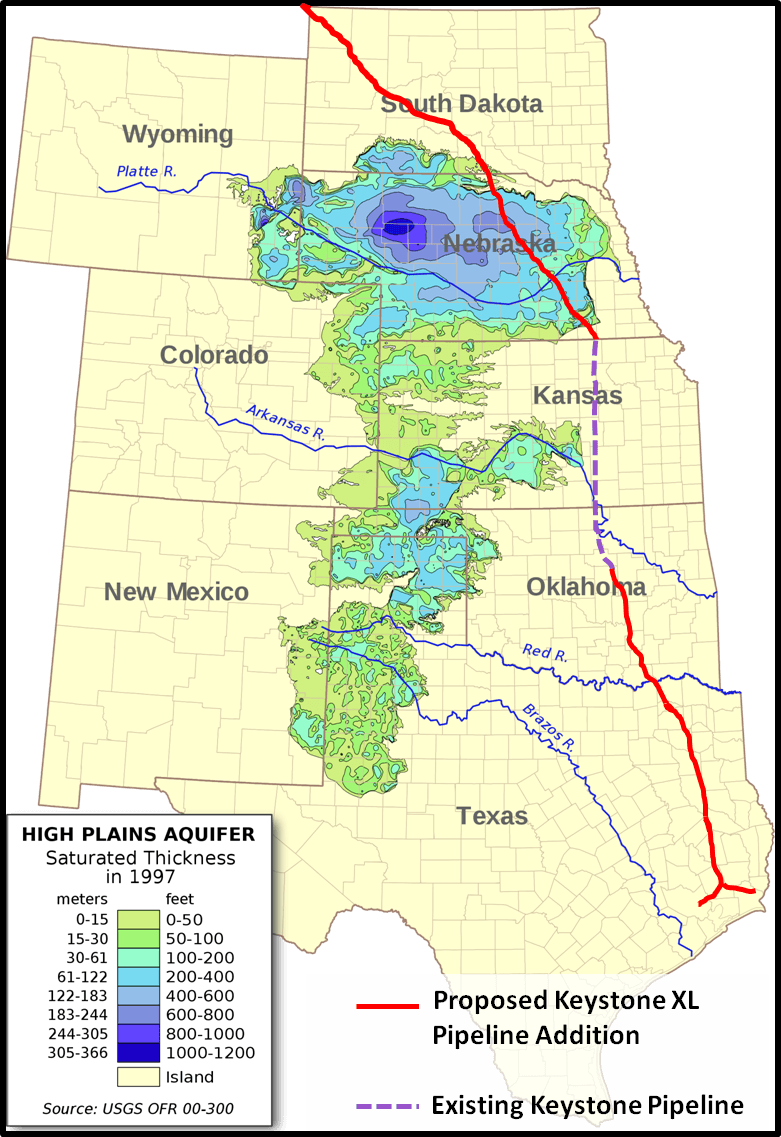
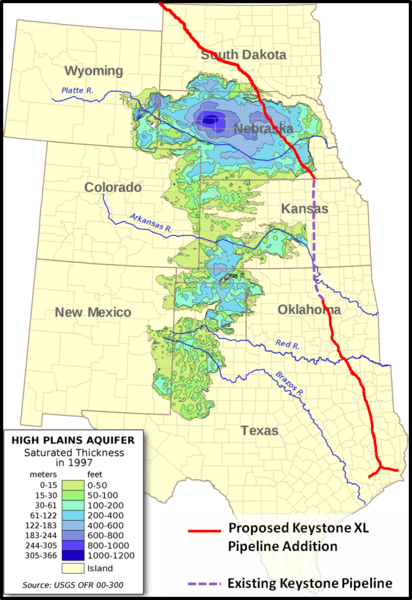
Image: Keystone XL - Ogallala Aquifer
Size of this preview: 412 × 600 pixels. Other resolutions: 165 × 240 pixels | 781 × 1,137 pixels.
Original image (781 × 1,137 pixels, file size: 625 KB, MIME type: image/png)
Description: A map showing aquifer thickness of the Ogallala Aquifer with the proposed Keystone XL Pipeline route laid over.
Author: Myself - Pipeline route, Kbh3rd - Aquifer Map
Usage Terms: Creative Commons Attribution-Share Alike 3.0
License: CC-BY-SA-3.0
License Link: http://creativecommons.org/licenses/by-sa/3.0/
Attribution Required?: Yes
Image usage
The following page links to this image:

All content from Kiddle encyclopedia articles (including the article images and facts) can be freely used under Attribution-ShareAlike license, unless stated otherwise.